Science & Environment
Wildfire Prediction Tools Improve Thanks to Alberta Satellite Project
Scientists in Edmonton are testing a new satellite-based algorithm to better forecast wildfires, potentially saving lives and ecosystems.
Published on 2025-08-01T16:15:28
By Emma Brunner
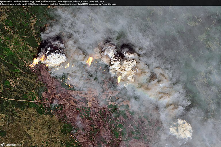
A new satellite-based wildfire detection tool developed in Alberta is giving firefighters and emergency planners a powerful new edge in predicting and containing wildfires. The project, spearheaded by the University of Alberta and Alberta Wildfire, combines high-resolution satellite imagery with predictive modeling to identify areas at highest risk of ignition.
The tool, called PyroCast, uses real-time weather patterns, vegetation dryness levels, and historical fire data to create a dynamic heat map of fire-prone regions. The data is updated hourly, allowing wildfire crews to pre-position resources before fires even start.
Dr. Miguel Santos, lead data scientist on the project, says the technology marks a shift from reactive to proactive firefighting. “With PyroCast, we’re not waiting for a smoke report. We’re anticipating where the next ignition is most likely to occur,” he explained.
The development follows two consecutive years of devastating wildfire seasons in Alberta and British Columbia, which caused billions in damage and forced tens of thousands to evacuate. Officials say new strategies are urgently needed as climate change continues to increase wildfire intensity and frequency.
The PyroCast system pulls data from Canadian satellites and partners with NASA to incorporate infrared readings during overnight hours, when aerial surveillance is limited. The result is a continuously refreshed risk map available to provincial response teams.
The tool was recently used during a grassland fire near Red Deer, where crews were able to contain the blaze within hours thanks to early warnings generated by PyroCast. Officials estimate that the rapid response prevented over $5 million in property losses.
The provincial government has announced $6.5 million in additional funding to expand the program, including training modules for municipal fire departments and integration with emergency apps used by the public.
Skeptics have questioned the reliance on satellite-based tech in densely wooded or mountainous terrain. However, Santos says new machine learning algorithms are improving terrain-specific predictions each month.
Residents in high-risk communities can expect to see new signage and alerts based on PyroCast data. Public awareness campaigns are also in development to help citizens better understand local fire risks and mitigation practices.
Environmental groups have praised the initiative for its potential to protect ecosystems. “This isn’t just about saving homes—it’s about preserving forests, watersheds, and biodiversity,” said Trina Norris, a spokesperson for Wildlands Canada.
If successful, the Alberta model could be exported to other fire-prone regions around the world. Talks are already underway with fire services in California and Australia, where similar challenges are driving demand for smarter fire forecasting tools.